Forest Monitoring with Drones
We recently, alongside Feedback Madagascar, partnered with Royal Botanical Gardens, KEW to undertake a pilot project aimed at photographing an ‘at risk’ forest area in Ambohimahamasina, a municipality we have been drilling wells in.
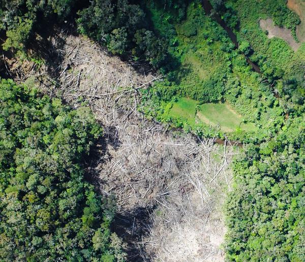
Deforestation tends to happen in the more remote areas of forest and is largely only known about and communicated in the realm of rumours amongst local people or via scientific reports published long after the act (and in formats inaccessible to local people). We’re empowering forest populations to protect their own forest by giving them access to the latest information gleaned by the latest technology.
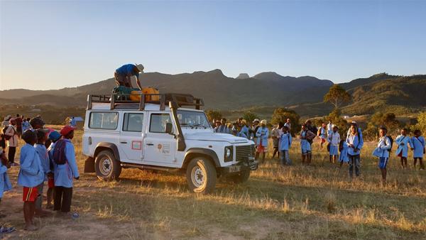
A team from RBG Kew, using a combination of drone and satellite imagery, were able to map over 1700 hectares over four days camping in the field. Using a generator, white sheet and portable projector, they were able to showcase the images taken from the drone flights with the local communities as and when they were photographed.
There is a wealth of data to analyse and further research to undertake over the next year, with the information used to educate and empower the local community to protect their valuable surroundings.
You can read more about the project on RBG Kew’s website here